
MITTAL INSTITUTE OF TECHNOLOGY & SCIENCE, PILANI
Remote Imaging, Sensing, and Processing: Revolutionizing Data Acquisition and Analysis
Introduction
In recent years, advancements in remote imaging, sensing, and processing have significantly transformed numerous industries, including healthcare, environmental monitoring, defense, agriculture, and space exploration. These technologies have paved the way for unprecedented data acquisition from inaccessible or hazardous environments. The evolution of these fields has paralleled the rise of big data, artificial intelligence (AI), and cloud computing, enabling computer scientists and researchers to analyze vast quantities of information efficiently. At an advanced research level, remote sensing, imaging, and processing represent a convergence of multiple disciplines, combining hardware innovations, sophisticated software algorithms, and machine learning models to extract actionable insights.
This essay will provide an in-depth analysis of these technologies, exploring their applications, challenges, and the future research directions for computer scientists working in the industry.
The Foundations of Remote Imaging and Sensing
Remote sensing refers to the process of acquiring information about an object or area from a distance, typically using sensors mounted on satellites, aircraft, drones, or unmanned systems. Remote imaging is a specific subset that captures visual or infrared data in the form of images, which can then be processed to reveal patterns, measurements, or objects of interest. These technologies rely on various types of sensors, including optical, radar, LIDAR (Light Detection and Ranging), hyperspectral, and thermal sensors.
Optical sensors capture light in the visible and near-infrared spectrum, while LIDAR sensors use lasers to measure distances to the Earth’s surface. Hyperspectral imaging captures data across many wavelengths of light, allowing the detection of unique signatures from materials. Radar sensors, especially synthetic aperture radar (SAR), are essential for capturing imagery under all weather conditions, as they penetrate clouds and operate independently of sunlight. This diversity of sensing technologies offers rich, multidimensional datasets that can be processed and analyzed for a wide range of applications.
Image and Signal Processing Techniques
The raw data captured by remote sensors undergoes significant processing to extract meaningful information. Image and signal processing techniques are essential for filtering noise, enhancing image quality, detecting patterns, and classifying objects. These processing methods can be divided into several stages:
- Preprocessing: Involves correction of geometric distortions, radiometric errors, and noise. It may also include georeferencing, where images are aligned to a specific geographic coordinate system.
- Segmentation and Feature Extraction: Image segmentation separates objects from the background, while feature extraction identifies relevant characteristics of objects (e.g., shape, size, texture, or spectral signature) for further analysis.
- Machine Learning and AI: AI models, particularly convolutional neural networks (CNNs) and deep learning architectures, have revolutionized remote sensing and imaging. These models are capable of automatically learning representations from data, making them well-suited for object detection, land cover classification, and change detection over time.
- Data Fusion: Combining data from multiple sources or sensors (e.g., optical and radar) enhances the accuracy and richness of the information extracted. Data fusion techniques use algorithms to integrate different types of data into a single, coherent dataset that can be analyzed more comprehensively.
- Postprocessing: After extracting features, postprocessing steps may include statistical analysis, visualizations, and decision-making processes based on the analyzed data.
Applications in Key Industries
The rapid advancement of remote imaging and sensing technologies has had a profound impact on several industries. Some of the most notable applications include:
- Environmental Monitoring: Remote sensing is essential for tracking climate change, deforestation, and biodiversity loss. By analyzing satellite imagery, researchers can monitor sea levels, glacial melt, deforestation rates, and pollution in real time. Hyperspectral imaging enables the detection of vegetation health, soil composition, and water quality, providing vital insights for sustainable agriculture and land management.
- Healthcare: In medical imaging, remote sensing technologies such as magnetic resonance imaging (MRI), computed tomography (CT), and ultrasound allow for the non-invasive diagnosis of diseases. Advanced image processing algorithms enable physicians to detect abnormalities with higher accuracy, contributing to improved patient outcomes.
- Defense and Security: In the defense industry, remote sensing plays a critical role in surveillance, reconnaissance, and battlefield situational awareness. High-resolution satellite imagery and radar data can be used to track military movements, identify threats, and support disaster response efforts.
- Space Exploration: Remote sensing is fundamental to space exploration. NASA, ESA, and other space agencies rely on imaging and sensing technologies to study planets, moons, and asteroids. For instance, the Mars rovers are equipped with sophisticated sensors that enable them to capture detailed surface images, analyze rock compositions, and detect signs of water or life.
- Urban Planning and Infrastructure: Remote sensing aids in monitoring urban sprawl, traffic patterns, and infrastructure development. LIDAR-based technologies are widely used in mapping cities and ensuring accurate 3D models for construction, disaster management, and infrastructure maintenance.
Challenges and Limitations
Despite the numerous advancements, remote imaging, sensing, and processing face several challenges that need to be addressed by the research community.
- Data Volume and Processing Complexity: The large volume of data generated by modern sensors presents a significant challenge in terms of storage, transmission, and processing. High-resolution satellite images or multispectral datasets often require advanced data compression techniques and efficient algorithms to process and analyze them in near real-time.
- Accuracy and Calibration: Ensuring the accuracy of remote sensing data involves complex calibration procedures. Sensors can experience drifts in sensitivity over time, leading to inaccuracies. Ground truthing—validating remote sensing data with in-situ measurements—remains a critical part of improving the accuracy of these systems.
- Cloud Computing and Edge Processing: While cloud computing has enabled researchers to process large datasets, the latency involved in transmitting data to the cloud and back poses challenges for time-sensitive applications. Emerging edge processing techniques—where data is processed locally near the sensor—can reduce latency but require sophisticated algorithms capable of running on resource-constrained devices.
- Environmental Factors: Weather conditions, atmospheric interference, and obstructions (e.g., clouds, vegetation) can degrade the quality of remote sensing data, especially in optical systems. Techniques such as SAR and multi-sensor data fusion can mitigate some of these effects, but further research is needed to improve data reliability under adverse conditions.
Future Research Directions
Several research areas hold promise for the future development of remote imaging, sensing, and processing technologies:
- AI-Driven Automation: The integration of AI and machine learning algorithms with remote sensing systems will enable fully automated image analysis, reducing the need for human intervention. Self-learning systems can continuously improve their performance by analyzing large volumes of data over time.
- Quantum Sensing and Imaging: Quantum technologies have the potential to revolutionize sensing and imaging, allowing for ultra-precise measurements and the ability to detect signals that are currently beyond the reach of classical systems.
- Edge AI and Real-Time Processing: Developing low-power AI models capable of running on edge devices will enable real-time processing of sensor data, leading to faster decision-making and applications such as autonomous drones and vehicles.
- Multisensor Data Fusion: Future research will likely focus on improving techniques for fusing data from heterogeneous sensors, leveraging the complementary strengths of different modalities to enhance accuracy and robustness.
- Advanced Visualization and VR/AR: Visualization technologies, such as virtual reality (VR) and augmented reality (AR), will become critical in interpreting complex remote sensing data, offering immersive and interactive environments for decision-makers.
Remote imaging, sensing, and processing have become essential tools in the modern world, enabling data acquisition from otherwise inaccessible environments. For computer scientists at an advanced research level, these technologies offer a rich and evolving field, with opportunities for significant contributions across hardware, software, and algorithmic domains. By addressing current challenges and exploring new frontiers, researchers can push the boundaries of what is possible, driving further innovation and transforming industries that rely on accurate and timely data.

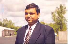
Professor Rakesh Mittal
Computer Science
Director
Mittal Institute of Technology & Science, Pilani, India and Clearwater, Florida, USA
